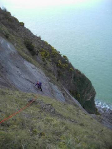
Exmoor Gullys.
1. This page is being
constructed and is not suitable as a guide. Please refer to guide books.
Coastal Climbs in N. Devon, C. Archer.
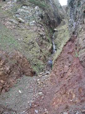
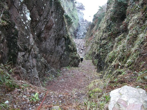
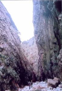
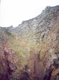
2. Much of the Exmoor Coastline is vegetated.
The density of the undergrowth varies with the seasons. This with erosion makes
access and escape uncertain as well as altering the line of the route within
the gully with changes to the grade.
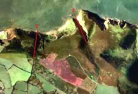
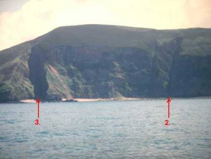
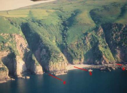
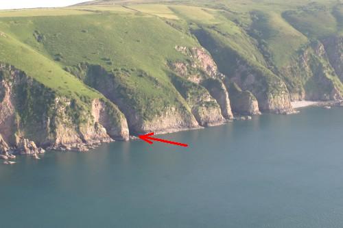
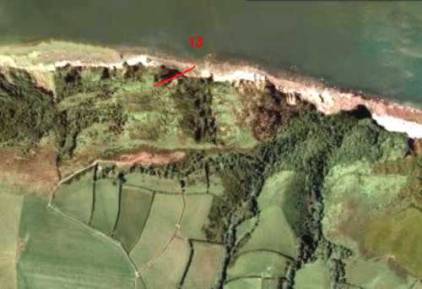
3. Grid references indicate
the base of the gully or a point on the beach immediately below the gully.
4. The height indicates the
contour at the exit from the gully. This may not be the top of the cliff.
5. The average angle is
shown. This may include vertical steps.
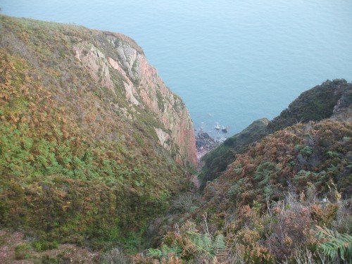
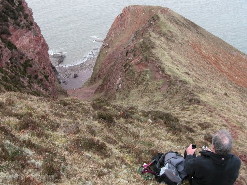
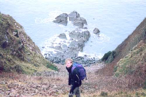
6. The Exmoor cliffs are
convex. You cannot see the bottom from the top. This makes route finding down
to the beach very difficult, usually involving the use of a rope and often more
hazardous than climbing the gully. Don’t try to find a way down without prior
knowledge. To do so will more than likely result in a wasted day or more
serious consequences.
7. The Exmoor Coast has the
second highest tidal range in the world. Do not get caught out on the beach or
within 40ft of it. If you must go down there then choose the low water of
spring tides. Consult a tide table.
8. The grades shown relate
to the English scrambling grades plus climbing grades where rock climbing has
to be performed at a standard above that normally experienced by scramblers.
This does not mean that scramblers cannot climb the gully, but should do so in
the company of a competent climber who has personal knowledge of their ability
on rock and is able to judge how they are coping with the difficulties.
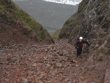
9. Take a rope, helmet, axe
and equipment that you would normally take on a mountain route. Being cut off
by the tide or benighted is a possibility especially during the winter months.
Mobile phone coverage is sporadic.
1. Little Hangman Gut. GR. SS 58723 48211.
Grade. 2
Exit contour. 195m.
Length. 919ft. 280m
Av Angle. 44 degrees.
Last climbed 21.10.07.
45ft of scree to foot of the first rock step. Depending on the amount of
scree the step may not exist or could be a 25ft waterfall covered in weed in
which case it will be grade 3. We walked into the base of the gully from YesTor
at half tide. Wait for a dry period.
2. Miners Gully. GR. SS 597483.
Grade. 3 (S)
Exit contour. 235m
Length. 1017ft. 310m
Av Angle. 50 degrees.
No recorded ascent. Not
led, top roped. Steep steps and very wet. Deep heather at top.
3. Great Hangman Gut. GR. SS 601484.
Grade. 3
Exit contour. 240m.
Length. 1279ft. 390m.
Av Angle. 39 degrees.
First 45m is loose, steep and
changeable red shale, grade 2 thereafter.
4. Notch Gully. GR. SS 630485.
Grade. 4. (VS 4a)
Exit contour. 140m.
Length. 690ft. 210m.
Av Angle. 43 degrees.
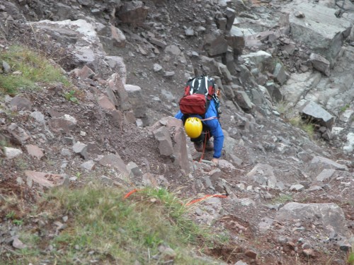
Last climbed 05.08.07. Allow 8 hours round trip for a group of three. Loose rock with poor protection in the groove make this a very dangerous undertaking. There is barely enough shelter for two from falling rock kicked off by the leader. We entered the initial shallow gully by climbing 5m left of the waterfall. There are then steps of 4 and 15ft followed by the crux, a steep 65ft groove in poor condition. This is followed by 12 and 5ft steps.
5. Hidden Gully. GR. SS 632484.
Grade 2.
Exit contour. 110m.
Length. 623ft. 190m.
Av Angle. 37 degrees.
Last visited 05.08.07. Start can be wet. Once inside the gully turn left up an earth / scree slope. Use trees for protection.
6. Neck Wood Gut. GR. SS 633485.
Grade. 3.
Exit contour. 180m.
Length. 1020ft. 310m.
Av Angle. 40 degrees.
Last climbed 18.02.06. A caving ladder was used to enter this gully during the 1960’s. Recently a slip has deposited debris at the foot of the feature providing an easy start. A 4ft step consisting of large boulders cemented together with soft red earth at about 520ft presents a dangerous obstacle. We passed it on the left side.
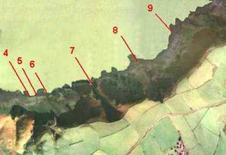
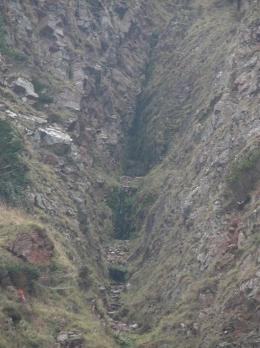
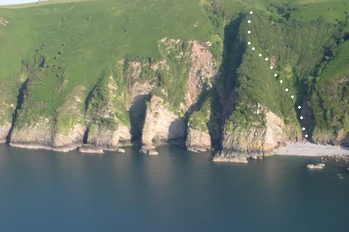
7. North Cleave Gut.
GR. SS 636485.
Grade. ?
Exit contour. 110m.
Length. 492ft. 150m.
Av Angle. 48 degrees.
No recorded ascent. Very steep and wet. The waterfall has an estimated length
of 300ft.
8. Bosley Gut. GR. SS 639486.
Grade. 1.
Exit contour. 220m
Length. 1115ft. 340m.
Av Angle. 40 degrees.
Descended 18.02.07. Care required handling the large
boulders in the first 100ft. No real obstacles thereafter.
9. Coxcomb West. GR. SS 643490.
Grade. 3 (S)
Exit contour. 100m
Length. 460ft.140m
Av Angle. 45 degrees.
Not visited recently. The continuation up the ridge and cliff above is an easy scramble of a further 460ft at 45 degrees. Deep heather near the top.
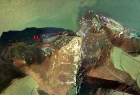
10. Tuesday Route. GR. SS 650495.
Grade. 2.
Exit contour. 150m.
Length. 689ft. 210m.
Av Angle. 42 degrees.
Not climbed recently. Bottom is loose changeable red shale. Easy thereafter. Head towards the pointed feature of Peter’s Rock, top left.
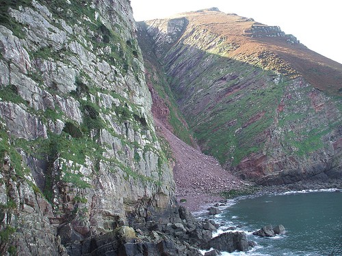
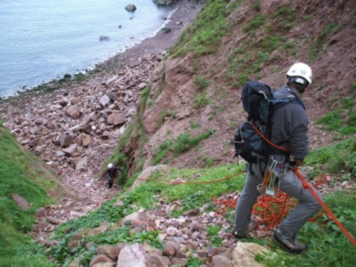
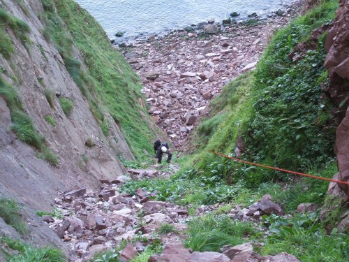
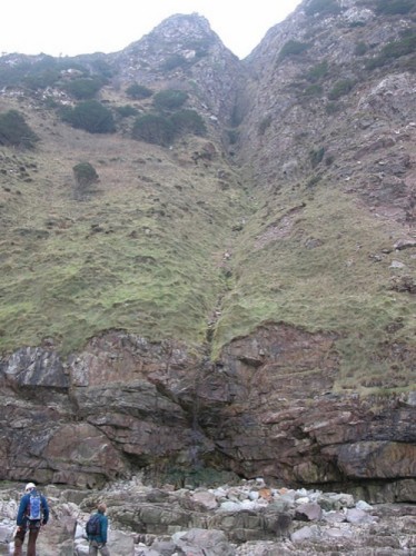
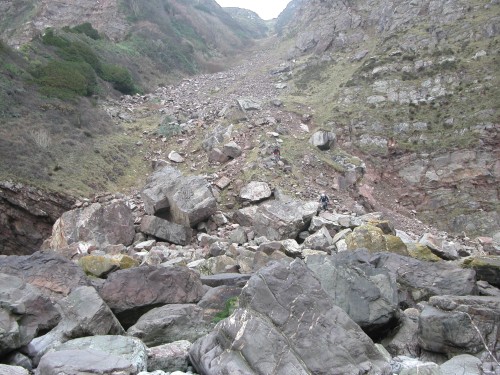
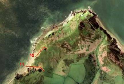
11. Great Red Gully. GR SS 74714 50457.
Grade. 2.
Exit contour. 240m.
Length. 1246ft. 380m.
Av angle. 36 degrees.
Last climbed 01.12.05. Allow 3 hours from and back to the car for a party of two. In its present condition this is not a route for a large party. Helmets, rope and axe are highly recommended. Keep tightly together to avoid dislodging rocks onto those below.

12. Coddow Slip. GR. SS 748506.
Grade. 2.
Exit contour. 200m.
Length. 950ft. 290m.
Av Angle. 44 degrees.
Last climbed 08.10.06. Starts at the foot of a landslip of large boulders.
Climb the boulder slope to the right hand corner into the gully proper.
The gully is now a clean V shape with escape up the steep grass slope to the left and onto the ridge.
At the next right turn the floor becomes clean rock for about 35ft topped by a 6ft rock step. At this point the sides of the gully are steep.
Continue up steep grass bearing left up to a metal stake. Climb up left from the stake to the top. Unfortunately someone has decided to test the stake and bent it to an angle where it cannot be removed leaving an eyesore.
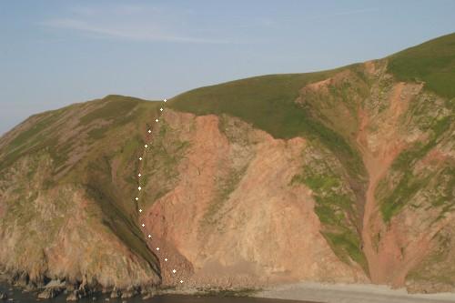
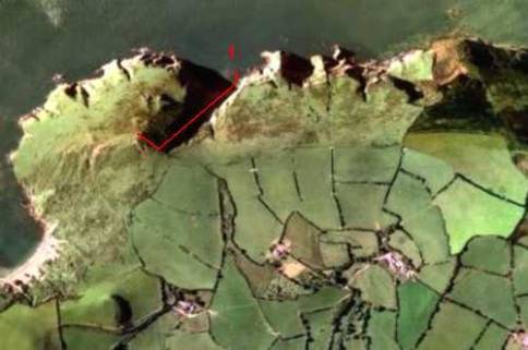
13. Whitebeam Gully. GR SS 77458 50124
Grade. 3 (S) + (VS 4b) climbing grade on steps. Grade 2 from the top of the gully to the footpath.
Exit contour. 110m, the path is on the 160m contour.
Length. 525ft. 160m. + further 225ft. 68m to path. Total = 750ft. 228m.
Av angle. 43 degrees.
Last climbed 01.04.07. Three rock steps. The first two (sometimes damp) have to be climbed at 4b tech grade. Take a size 10 or 11 hex for the
second step (VS). The third one, forming the large headwall can be bypassed on the left side, or climb the slab until you want to exit left.
This is a very remote location. If walking
in from the A39 allow for a round trip of 7hrs for a group of three.
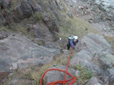
The first rock step.
The second rock step The top slab
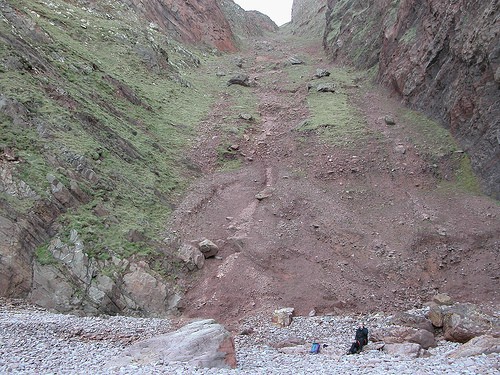
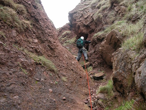
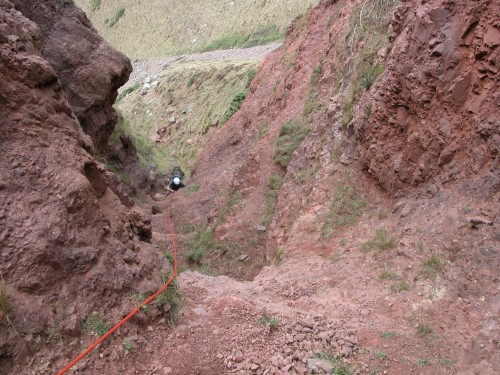
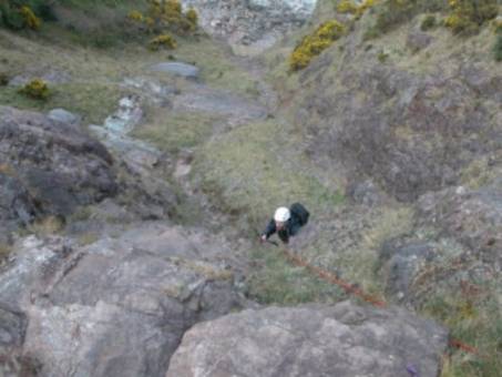
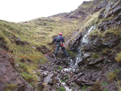
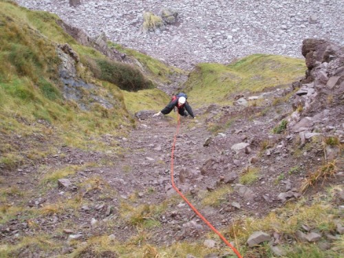
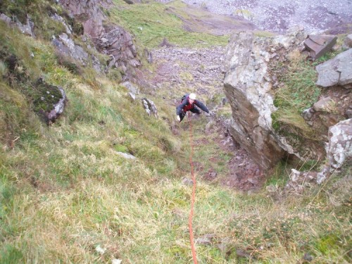
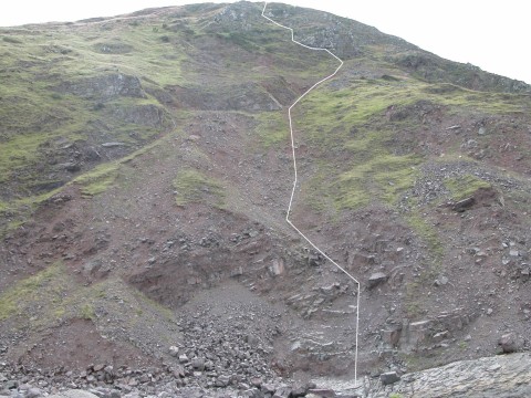
14. Henners Hill West. GR. SS 910492
Grade. 2
Exit Contour. 150m
Length. 1148ft. 350m
Av Angle. 40 degrees.
Last climbed 10.01.08. Follow the watercourse until it
enters the gully from the right. (2nd photo) Continue ahead up the shallow gully to belay at the outcrop on the
right. Move back out into the gully and continue up steep red shale, then move
left to the steep and narrow gully (4th photo) Continue moving left
under the cliff until under the highest point then direct to the top.
15. Henners Hill. GR. SS 912492
Grade. 3
Exit Contour. 150m
Length. 656ft. 200m
Av Angle. 45 degrees.
Last climbed 11.11.07. The initial 150ft is very loose,
unprotected and dangerous. Thereafter this is a grade 1 scramble. Follow the
line of the shallow gully up the hill bypassing the buttress then direct to the
top. The buttress has been climbed by mounting the large ledge and moving to
the right side where it is possible to climb in an exposed situation on large
holds. Protection in the cracks. The final move from the large ledge up onto
the hillside requires a long reach with an axe.
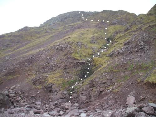
16. Grexy Combe. GR. SS 940486
Grade. 1.
Exit Contour. 80m
Length. 689ft. 210m
Av Angle. 20 degrees.
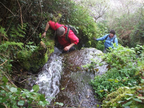
Last climbed 27.04.08. Enter the watercourse while trying to keep the feet dry. Climb the greasy waterslide with the aid of a fallen tree (2nd photo) About 200m upstream is a 12 / 15ft waterfall. We climbed this on the right then moved back left in an horizontal fashion with the left ear almost in the water before pulling out over the lip of the fall. It is possible to escape out of the combe by climbing the steep left (east) bank to the fence line which can be followed to the top of the hill.
Back to Exmoor Coast Climbing.