Anglesey Branch Canal - 1850
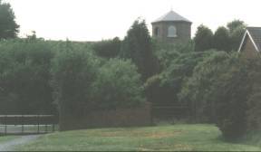
 Looking along the dam of Chasewater or Norton Pool as it
was previously known. This picture was taken during a
particularly dry summer and the water level is well below
the overflow culverts. Overflow water is taken via
several pounds to the canal as shown later.
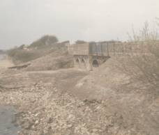
Looking along the dam of Chasewater or Norton Pool as it
was previously known. This picture was taken during a
particularly dry summer and the water level is well below
the overflow culverts. Overflow water is taken via
several pounds to the canal as shown later.The Cannock Chase Reservoir (Chasewater) was opened in 1799 and feeds water to the whole of the current Wyrley and Essington, and beyond. Taken looking North.
From the other side of
the dam and at the end of a wet winter. The water level
is at maximum and the first overflow pound is full and
draining into the second.
Taken looking Southwest.
Access from Pool Road (off A5 Watling Street).
 Looking along the dam
of Chasewater
Looking along the dam
of Chasewater(or Norton Pool)
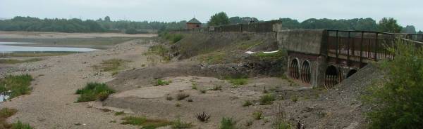
The reservoir drained for major repair work.
(photo taken 3/9/2011)
 Looking along the dam
of Chasewater
Looking along the dam
of Chasewater
(or Norton Pool) on the canal side.
When the reservoir was drained for major repair work.
(photo taken 3/9/2011)
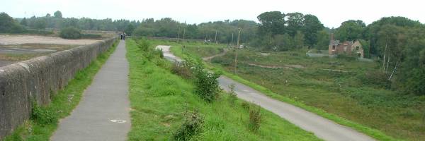
 Looking back to the dam of Chasewater or Norton Pool as it
was previously known. Pool Road (off the A5 Watling
Street) leads to this point.
Looking back to the dam of Chasewater or Norton Pool as it
was previously known. Pool Road (off the A5 Watling
Street) leads to this point. The Cannock Chase Reservoir (Chasewater) was opened in 1799 and feeds water to the whole of the current Wyrley and Essington, and beyond.
Taken looking back West.
Access from Pool Road (off A5 Watling Street).
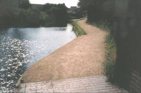
As at April 2015 the narrow access to towpath is now
three feet wide as the obstructing post has been cut off
at ground level.
 Taken looking
SouthEast.
Taken looking
SouthEast.Access from Pool Road (off A5
Watling Street).
As at April 2015 the narrow access to towpath is now
three feet wide as the obstructing post has been cut off
at ground level.
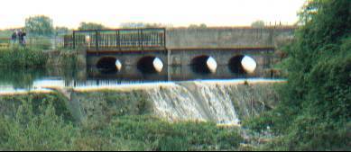
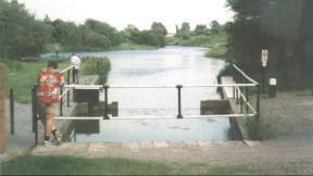
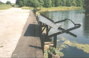
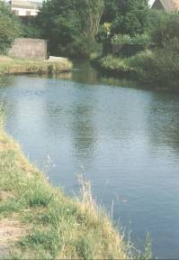
 Overflow
from Chasewater into canal.
Overflow
from Chasewater into canal.Taken looking South.
Access along canal.
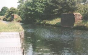 Bases of the two overhead coal-loading gantries.
 Taken from opposite overflow looking East.
Access along canal.
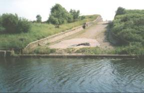
 Coal
loading shutes from the path of the now removed
colliery railway.
Coal
loading shutes from the path of the now removed
colliery railway.Taken looking South toward Wharf Lane.
Access from Wharf Lane may no longer be possible.
 Burntwood Road
Bridge (under Whitehorse Road) - Soon to be
drastically altered by the BNRR (Birmingham North Relief
Road). The new motorway toll road has now been officially
named M6(Toll). The BNRR has caused the closure of the
road link between Brownhills (Whitehorse Road) and
Burntwood (Wharf Lane). The canal and towpath will remain.
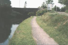
Burntwood Road
Bridge (under Whitehorse Road) - Soon to be
drastically altered by the BNRR (Birmingham North Relief
Road). The new motorway toll road has now been officially
named M6(Toll). The BNRR has caused the closure of the
road link between Brownhills (Whitehorse Road) and
Burntwood (Wharf Lane). The canal and towpath will remain.Taken looking South.
NO access from Wharf Lane. Foot access to Whitehorse Road from the towpath after passing under the bridge.
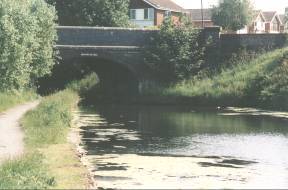
 Burntwood Road
Bridge (under Whitehorse Road)
Burntwood Road
Bridge (under Whitehorse Road) Taken looking back North.
NO access from Wharf Lane. Foot access to Whitehorse Road via the top right of this picture.
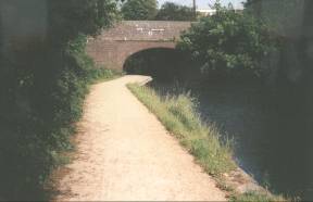
 Freeth Bridge
(under Watling Street) - This is the modern addition to
carry the widened road of the early 1970s.
Freeth Bridge
(under Watling Street) - This is the modern addition to
carry the widened road of the early 1970s.Taken looking South.
Access from The Watling Street (A5)
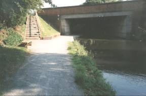
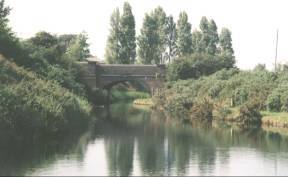
 Freeth Bridge
1849 (under Watling Street) - The original part of the
bridge. Named after the canal engineer, Mr. John Freeth (Clerk
to the Birmingham Canal Navigation Co.), who was
responsible for the building of the bridge when the
Angelsey Branch was cut.
Freeth Bridge
1849 (under Watling Street) - The original part of the
bridge. Named after the canal engineer, Mr. John Freeth (Clerk
to the Birmingham Canal Navigation Co.), who was
responsible for the building of the bridge when the
Angelsey Branch was cut.Taken looking back North.
Access from Watling Street (A5)
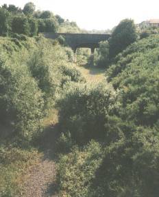 Aquaduct over railway. The railway line
has now been removed but may be reinstated as a passenger
railway or a tram line.
Aquaduct over railway. The railway line
has now been removed but may be reinstated as a passenger
railway or a tram line.Left - Taken looking East (toward Middleton Bridge). Access along canal.
Right - Taken looking SouthWest from Newtown Bridge (A5). Access along canal (via Chase Road or The Watling Street).
 Aquaduct over
railway.
Aquaduct over
railway. Taken looking back West toward aquaduct from under Middleton Bridge.
Access along canal.
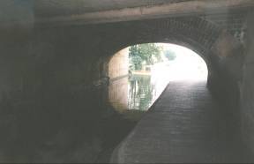
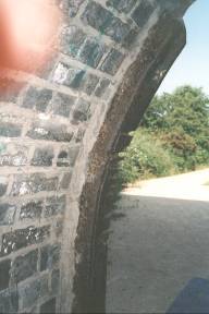 Middleton Bridge
(under Chase Road) - worn by the tow-ropes of horse-drawn
narrowboats.
Middleton Bridge
(under Chase Road) - worn by the tow-ropes of horse-drawn
narrowboats.The bridge was named after William Middleton, a landowner and farmer of the area.
Taken looking East.
Access from Chase Road.
 Middleton Bridge
(under Chase Road).
Middleton Bridge
(under Chase Road).Taken looking East.
Access from Chase Road at the other side of the bridge.
 Anglesey Bridge (signed
1850) - (under Lichfield Road).
Anglesey Bridge (signed
1850) - (under Lichfield Road).The poplar trees beyond the bridge mark the site of "The Chemical", a landmark up to the demolition of its tall brick chimney in 1987. Brownhills Chemical Works was opened in 1870, taking advantage of the canal to bring materials from the gasworks at the other side of Brownhills. From the Second World War aluminium alloys were smelted at the site. As "Super Alloys" scrap Gloster Meteor and Javelin aircraft where stacked at the works, awaiting recycling.
Taken looking back North from Ogley Junction (or Anglesey Junction).
Access from Lichfield Road.