Rushall Canal including the Daw End Branch / Longwood Branch
 Catshill Junction Bridge. The footbridge
crosses the Rushall Canal that runs 8 miles down 9 locks
to meet the the Tame Vally Canal under the M6/M5 motorway
interchange at Ray Hall, Walsall.
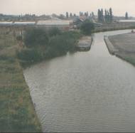
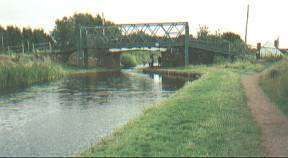
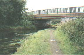
Catshill Junction Bridge. The footbridge
crosses the Rushall Canal that runs 8 miles down 9 locks
to meet the the Tame Vally Canal under the M6/M5 motorway
interchange at Ray Hall, Walsall.In the right foreground is the toll halt at the start of the branch.
Taken looking North.
Access via towpath
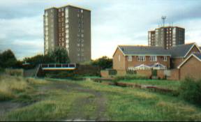
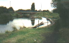
 Toll halt This divided the canal into two halfs with a
centeral island. In this 1982 picture the left hand route
is already overgrown through lack of use.
Toll halt This divided the canal into two halfs with a
centeral island. In this 1982 picture the left hand route
is already overgrown through lack of use.Taken from Catshill Junction Bridge footbridge looking South.
Access via towpath
 Clayhanger
Bridge This 1993 view taken just before rebuilding
of the bridge
Clayhanger
Bridge This 1993 view taken just before rebuilding
of the bridgeTaken looking West.
Access via Clayhanger Road
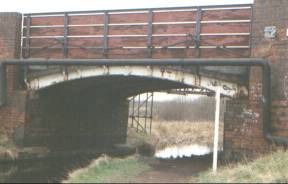
 Clayhanger
Bridge The new bridge is dated 1994. The overflow
in right foreground ensures that the waterlevel of the
canal does nor rise too high.
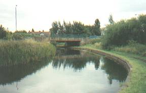
Clayhanger
Bridge The new bridge is dated 1994. The overflow
in right foreground ensures that the waterlevel of the
canal does nor rise too high.Taken looking West.
Access via Clayhanger Road
 Blackcock Bridge
This section of the canal does pass
through an area of some subsidence resulting from the old
workings of the Walsall Wood Collery. The roof of the
"Black Cock Inn" pub (in the distance, on the
right) is level with the towpath - once the front door
step was level with the canal - this is an urban myth!
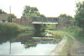
Blackcock Bridge
This section of the canal does pass
through an area of some subsidence resulting from the old
workings of the Walsall Wood Collery. The roof of the
"Black Cock Inn" pub (in the distance, on the
right) is level with the towpath - once the front door
step was level with the canal - this is an urban myth!Taken looking West.
Access via Camden Street/Green Lane/Hall Lane.
 Walsall Wood
Bridge
Walsall Wood
Bridge Taken looking South.
Access via Walsall Road/High Street via steps.
 Hollanders Bridge
Taken looking South.
Access to the towpath from the bridge is a bit rough - Bridge open to pedestrians only - Road access from Boatmans Lane or East end of Queen Street.
 Latham's Bridge
dated 1982.
Latham's Bridge
dated 1982.Taken looking West.
Access from Boatmans Lane